Battlefield Photos - Then and Now
Many first-time visitors to the First World War battlefields are often unsure of what there is to be seen 100 years after the event. In this section, I'll try to show 1/500,000th of one portion - the British Front Line! There are more than 3,900 British & Commonwealth cemeteries in Northern France/Flanders, and perhaps ten times as many memorials. To see a few additional photos of my more (on-location) visits, have a look at the French Battlefields section on this site.
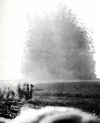
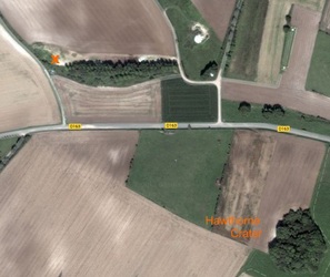
Above. Photo 1. This famous wartime photo - taken by the Official War Photographer Geoffrey Malins - show the British mine going off at Beaumont Hamel, at 7.30am on the morning of 1st July, 1916, killing and wounding hundreds of German soldiers. Malins was on top of a frontline British Dugout, about 150 yards from the German Front Line. This mine was one of several set off that morning. Unfortunately, this one was ten minutes later than the others, thus allowing the Germans to re-group in preparation for the British advance that they knew was coming. The aerial photo next to it, shows the crater as it is today, while 'X' marks the "White City" location from where Malins took this photo.
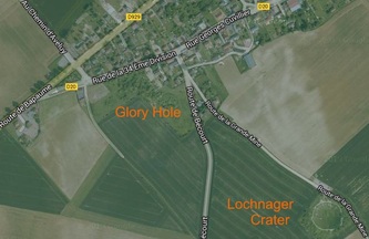
Photo 3 shows the village of la Boisselle with the Lochnager Crater at bottom right. The crater was the largest made by any mine, and again, killed many of the enemy. It is approximately 300 feet in diameter. Note the trench scarring still visible today. Recent (and continuing) excavations at the Glory Hole have revealed one of the original British tunnels used to plant the mine explosives - and two of the named miners who lost their lives in the process!
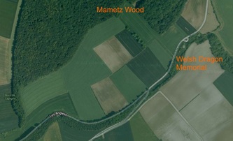
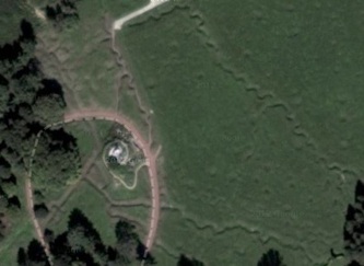
Photo 4 shows the southern end of Mametz Wood and location of the Welsh Memorial, while Photo 5 shows the area the Welshmen had to traverse. The Memorial is just to left of the photo.
Photo 6 covers most of the Newfoundland Park area where the only Commonwealth Nation to take part in the 1st July attacks - The Newfoundlanders - were virtually wiped out.
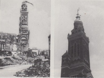
Photo 7 is another famous one - The Leaning Virgin in Albert. The sculpture hung like this throughout most of the war, and British troops often claimed that the war would end when the Virgin fell. It fell about one week before the 1918 Armistice! Photo 8 shows it as it is today. The City of Birmingham paid for most of the town's reconstruction.
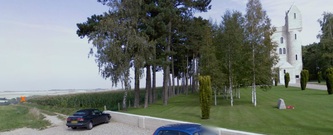
Photo 9 is the Ulster Tower - the area being the first objective of the 36th Ulster Division. 'X' marks the spot known as The Pope's Nose - a deadly machine-gun post that caused many British casualties. In fact, the Ulstermen were the only unit to take their objectives, but sadly, could not hold them due to lack of support. Photo 10 - taken from the same point, shows the path from the Thiepval Wood treeline which the men had to take to reach the Schwaben Redoubt (off to left of picture), the sunken road (the "Road of Blood") and, in the distance, Thiepval Memorial to the Missing.
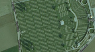
Photo 11. The largest Commonwealth cemetery in the world - Tyne Cot, Passchendaele, Flanders.
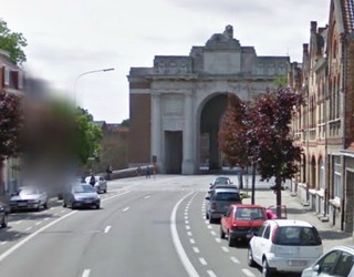
Photo 12. The Menin Gate Memorial to The Missing, Ypres. A simple ceremony is performed here every evening, when the City's Fire Brigade play The Last Post, a tribute to all those British and Commonwealth troopswho served in the region. The ceremony has taken place every evening (except during WW2) since the end of the war.
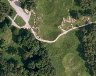
Photo 13 is an aerial view of the trenches and shell-pocked ground at Vimy Ridge. The trenches on the left are Canadian, and those on the right are German. The distance between is less than 30 feet!! I've shown only a fraction of the parkland - much of it still containing extant explosives. There are three tiers of underground tunnels, although only a small portion is open to visitors, guided by Canadian students who do an unpaid three-month stint as guides.
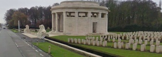
Photo 14 shows British Lions guarding the Ploegsteert ("Plug Street" to British troops), Memorial to the Missing, and Berks Corner Cemetery extension. Plug Street Wood was the scene of the famous 1914 Christmas Truce.
